
Loading Remote Sensing Telemetry...
K.K. Puri Colony, Awas Vikas, Shivpuri Road, Jhansi (U.P.) 284003
GIS, Remote Sensing & Social Work
Loading Remote Sensing Telemetry...
Remote Sensing Agriculture Knowledge Help Integral Society (RAKHI-Society), established in 2017 under Program Director Rakhi Shukla and Remote Sensing Lead Anil Kumar Shukla (RS&GIS-(IIRS-ISRO)). Delivering high-precision 3D GIS mapping, soil, other type social work and watershed development across Bundelkhand, Uttar Pradesh, and India.
37+
GIS & Agri Projects
15,000+
Soil Samples Tested
2017
Established Year
100%
Bundelkhand Commitment
Utilizing DGPS surveys, satellite remote sensing, and 3D volumetric building footprint extraction across K.K. Puri Colony, Awas Vikas, and regional agricultural zones.
K.K. Puri Colony, Awas Vikas, Jhansi
High-precision satellite mapping, 3D building modeling, land-use classification, and cadastral spatial analytics.
Soil health testing and nutrient mapping support for understanding soil conditions and improving spatial planning and agricultural decision-making.
Detailed Project Report (DPR) formulation, contour mapping, check-dam design, and watershed conservation.

Director
DirectorProgram Director & GIS Lead
K.K. Puri Colony, Awas Vikas, Shivpuri Road, Jhansi (U.P.) 284003
| S.N. | Project Name | Funder / Partner | Period | Beneficiary Region |
|---|---|---|---|---|
| 1 | Groundwater GIS Mapping | Moti Lal Engineering College, Allahabad | 2017 | Allahabad, Kanpur, Pratapgarh, Fatehpur |
| 2 | Soil Health Card Mahoba Project | D.D. Agriculture Mahoba | 2017-2020 | Mahoba District |
| 3 | Soil Health Card Jhansi Project | D.D. Agriculture Jhansi | 2017-2020 | Jhansi District |
| 4 | IWMP DPR & GIS Mapping (Jhansi) | Sichai Evam Jal Sansadhan Vibhag Jhansi | 2009-2011 | Jhansi |
| 6 | PMKSY DPR & GIS Mapping Jhansi | D.D. Agriculture Jhansi | 2018-2019 | Jhansi |
| 8 | Namami Gange GIS Mapping Project | Agriculture Mukhayalay Uttar Pradesh | 2021 | Uttar Pradesh River Basins |
How high-resolution DEM elevation maps allow accurate stream order modeling and groundwater recharge zone identification in semi-arid terrains.
Analyzing empirical data from 15,000+ soil testing samples processed by RSAK Society in Mahoba and Jhansi districts.
Deploying high-resolution spatial datasets and building height extraction for municipal planning and infrastructure analysis.
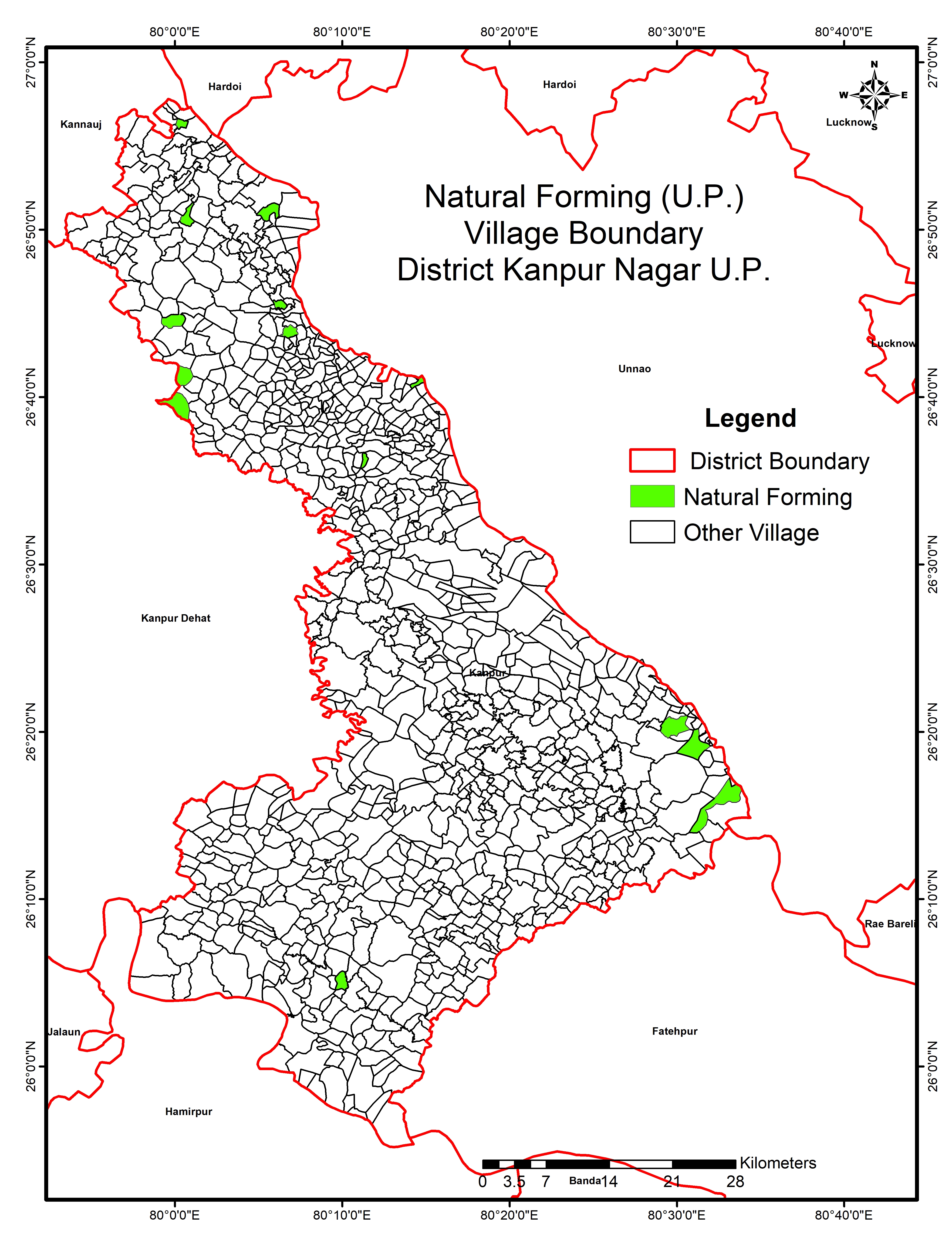
RSAKHI Society has developed a natural farming model using GIS technology for farm-level monitoring, satellite-based observation, land-use change detection and assessment of farm-specific information including Khasra/plot numbers and cluster mapping.
Contact Remote Sensing Agriculture Knowledge Help Integral Society for government DPR preparation, satellite topography surveys, and soil fertility cards.